חורבת עמודה
Morning Trail Run
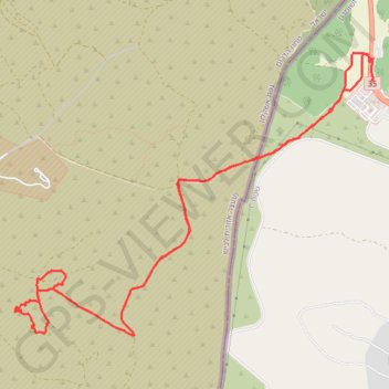
- Distance: 14.4 Km
- Elevation gain: 307 m
- Maximum elevation: 397 m
- Elevation loss: 303 m
- Minimum elevation: 324 m
- Moving time: 2 h 12 m
- Moving speed: 6.5 Km/h
- Maximum speed: 48.5 Km/h
- Total time: 2 h 42 m
- Global speed: 5.3 Km/h
Interactive trail map
Trail profile
- Distance: 14.4 Km
- Elevation gain: 307 m
- Maximum elevation: 397 m
- Elevation loss: 303 m
- Minimum elevation: 324 m
- Moving time: 2 h 12 m
- Moving speed: 6.5 Km/h
- Maximum speed: 48.5 Km/h
- Total time: 2 h 42 m
- Global speed: 5.3 Km/h
About this trail
Name: חורבת עמודה trail, distance, elevation, map, profile, GPS track
End: 35, Area C, Judea and Samaria, Palestinian Territory (31.59327 34.96163)
Coordinates: 31.56949 34.92267 31.59579 34.96194