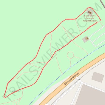
Clark Picnic Grounds
- Distance: 0.7 Km
- Elevation gain: 4 m
- Maximum elevation: 149 m
- Elevation loss: 4 m
- Minimum elevation: 145 m
- Moving time: 9 m 42 s
- Moving speed: 4.6 Km/h
- Maximum speed: 6.3 Km/h
- Total time: 9 m 42 s
- Global speed: 4.6 Km/h
Interactive trail map
Trail profile
- Distance: 0.7 Km
- Elevation gain: 4 m
- Maximum elevation: 149 m
- Elevation loss: 4 m
- Minimum elevation: 145 m
- Moving time: 9 m 42 s
- Moving speed: 4.6 Km/h
- Maximum speed: 6.3 Km/h
- Total time: 9 m 42 s
- Global speed: 4.6 Km/h
About this trail
Name: Clark Picnic Grounds trail, distance, elevation, map, profile, GPS track
Coordinates: 15.20412 120.54272 15.20634 120.54519