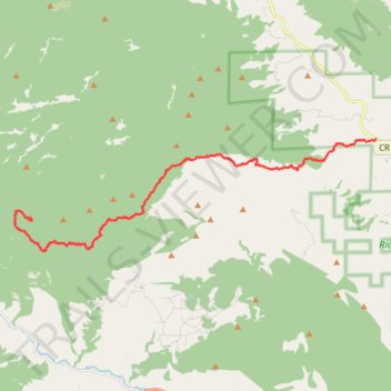
Trails and roads to the Storm Mountain summit
- Distance: 18.4 Km
- Elevation gain: 1,410 m
- Maximum elevation: 3,002 m
- Elevation loss: 101 m
- Minimum elevation: 1,690 m
Interactive trail map
Trail profile
- Distance: 18.4 Km
- Elevation gain: 1,410 m
- Maximum elevation: 3,002 m
- Elevation loss: 101 m
- Minimum elevation: 1,690 m
About this trail
Name: Trails and roads to the Storm Mountain summit trail, distance, elevation, map, profile, GPS track
Start: 12134, Buckhorn Road, Larimer County, Colorado, 80538, United States (40.50972 -105.24650)
End: Foggy Park Road, Larimer County, Colorado, 80515, United States (40.48512 -105.38591)
Coordinates: 40.47547 -105.39213 40.50972 -105.24650