
Red Bluff, Mississippi's "Little Grand Canyon"
Red Bluff offers a scenic and adventurous hiking experience that starts just off the abandoned Highway 587, near Foxworth. The route provides stunning views of colorful clay cliffs, steep ravines, and a rugged landscape shaped by ongoing erosion, making it feel both otherworldly and dynamic. Though there are no official trails or maintenance, the freedom to explore the canyon's rim or descend its steep paths rewards hikers with unique perspectives, though caution is advised due to loose soil and the potential for debris from runoff. #Hiking #Cliff #Forest #Nature
- Distance: 1.6 Km
- Elevation gain: 81 m
- Maximum elevation: 111 m
- Elevation loss: 81 m
- Minimum elevation: 65 m
- Moving time: 46 m 3 s
- Moving speed: 2.1 Km/h
- Maximum speed: 4.9 Km/h
- Total time: 1 h 15 m
- Global speed: 1.3 Km/h
Interactive trail map
Trail profile
- Distance: 1.6 Km
- Elevation gain: 81 m
- Maximum elevation: 111 m
- Elevation loss: 81 m
- Minimum elevation: 65 m
- Moving time: 46 m 3 s
- Moving speed: 2.1 Km/h
- Maximum speed: 4.9 Km/h
- Total time: 1 h 15 m
- Global speed: 1.3 Km/h
About this trail
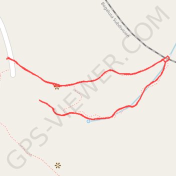
Name: Red Bluff, Mississippi's "Little Grand Canyon" trail, distance, elevation, map, profile, GPS track
Start: MS 587, Marion County, Mississippi, 39483, United States (31.32734 -89.94695)
End: MS 587, Marion County, Mississippi, 39483, United States (31.32737 -89.94692)
Coordinates: 31.32607 -89.94695 31.32739 -89.94296