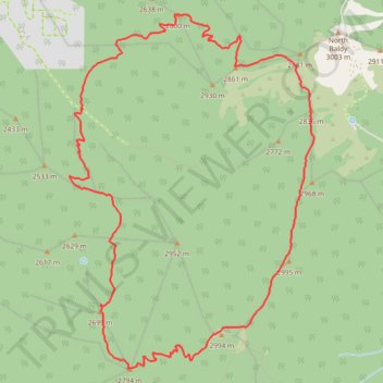
Cibola National Forest hike
- Distance: 14.7 Km
- Elevation gain: 843 m
- Maximum elevation: 3,006 m
- Elevation loss: 843 m
- Minimum elevation: 2,364 m
- Moving time: 4 h 22 m
- Moving speed: 3.4 Km/h
- Maximum speed: 6.1 Km/h
- Total time: 4 h 59 m
- Global speed: 3.0 Km/h
Interactive trail map
Trail profile
- Distance: 14.7 Km
- Elevation gain: 843 m
- Maximum elevation: 3,006 m
- Elevation loss: 843 m
- Minimum elevation: 2,364 m
- Moving time: 4 h 22 m
- Moving speed: 3.4 Km/h
- Maximum speed: 6.1 Km/h
- Total time: 4 h 59 m
- Global speed: 3.0 Km/h
About this trail
Name: Cibola National Forest hike trail, distance, elevation, map, profile, GPS track
Start: Trail #25, Socorro County, New Mexico, United States (34.04256 -107.21237)
End: Trail #25, Socorro County, New Mexico, United States (34.04257 -107.21236)
Coordinates: 34.01633 -107.21405 34.05219 -107.18404