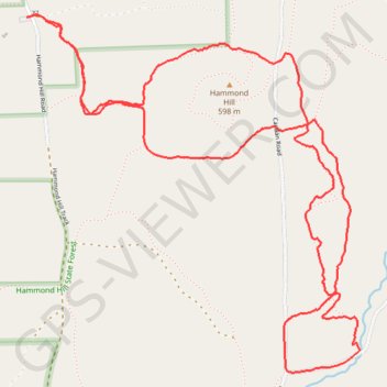
Hammond Hill trails Y7 Y8
- Distance: 7.5 Km
- Elevation gain: 214 m
- Maximum elevation: 602 m
- Elevation loss: 214 m
- Minimum elevation: 472 m
- Moving time: 1 h 19 m
- Moving speed: 5.6 Km/h
- Maximum speed: 10.9 Km/h
- Total time: 1 h 19 m
- Global speed: 5.6 Km/h
Interactive trail map
Trail profile
- Distance: 7.5 Km
- Elevation gain: 214 m
- Maximum elevation: 602 m
- Elevation loss: 214 m
- Minimum elevation: 472 m
- Moving time: 1 h 19 m
- Moving speed: 5.6 Km/h
- Maximum speed: 10.9 Km/h
- Total time: 1 h 19 m
- Global speed: 5.6 Km/h
About this trail
Name: Hammond Hill trails Y7 Y8 trail, distance, elevation, map, profile, GPS track
Coordinates: 42.42257 -76.30575 42.43726 -76.28725