
Veliki Vukan
<p>Start time: 01/01/2018 13:41<br/>Finish time: 01/01/2018 15:09<br/>Distance: 4 km (01:28)<br/>Moving time: 00:54<br/>Average speed: 2.74 km/h<br/>Avg. Speed Mov.: 4.47 km/h<br/>Max. speed: 7.39 km/h<br/>Minimum altitude: 207 m<br/>Maximum altitude: 823 m<br/>Ascent speed: 68.4 m/h<br/>Descent speed: -425 m/h<br/>Elevation gain: 1 m<br/>Elevation loss: -613 m<br/>Ascent time: 00:01<br/>Descent time: 01:26<br/></p><hr align="center" width="480" style="height: 2px; width: 517px"/>
- Distance: 8.2 Km
- Elevation gain: 609 m
- Maximum elevation: 809 m
- Elevation loss: 609 m
- Minimum elevation: 207 m
- Moving time: 2 h 17 m
- Moving speed: 3.6 Km/h
- Maximum speed: 6.3 Km/h
- Total time: 3 h 28 m
- Global speed: 2.4 Km/h
Interactive trail map
Trail profile
- Distance: 8.2 Km
- Elevation gain: 609 m
- Maximum elevation: 809 m
- Elevation loss: 609 m
- Minimum elevation: 207 m
- Moving time: 2 h 17 m
- Moving speed: 3.6 Km/h
- Maximum speed: 6.3 Km/h
- Total time: 3 h 28 m
- Global speed: 2.4 Km/h
About this trail
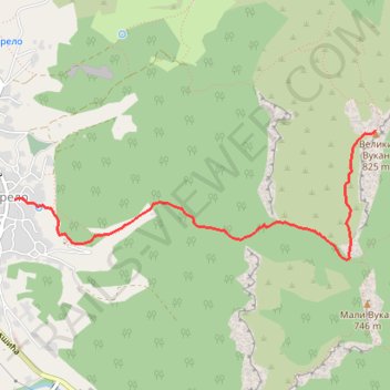
Name: Veliki Vukan trail, distance, elevation, map, profile, GPS track
Coordinates: 44.29063 21.50550 44.29899 21.53824
Other hiking, mountain biking, running and outdoor activity trails
Click on a trail to view its statistics, map and profile.

MALI I VELIKI VUKAN GREBENOM - Kružna tura od 4 lule
Serbia > Central Serbia > Branicevo Administrative District > Petrovac-na-Mlavi Municipality > Zdrelo
Distance: 9.1 Km • Elevation gain: 771 m • Maximum elevation: 809 m
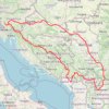
2022_Yu
Slovenia > Ajdovščina > Žapuže
Distance: 2,457.3 Km • Elevation gain: 32,048 m • Maximum elevation: 1,950 m