Import a GPX file

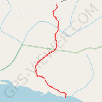
Raft Cove Trail

Raft Cove Provincial Park. Vancouver Island. #Hiking #RaftCove #Vancouver #Pacific

  • Distance: 3.5 Km
  • Elevation gain: 120 m
  • Maximum elevation: 67 m
  • Elevation loss: 120 m
  • Minimum elevation: 0 m

Interactive trail map

Trail profile

  • Distance: 3.5 Km
  • Elevation gain: 120 m
  • Maximum elevation: 67 m
  • Elevation loss: 120 m
  • Minimum elevation: 0 m

About this trail
Gear up for your next adventure:

🗺️Topographic Maps - Detailed maps for hiking and navigation
💧Personal Water Filters - Drink safely from streams and lakes identified on your map
📖Australian Bush Survival Books - Local knowledge on finding water and surviving the outback
🦯Adjustable Trekking Poles - Reduce impact on knees when descending steep topographic ridges
🦶Orthotic Hiking Insoles - Extra arch support for long-distance topographic treks

As an Amazon Associate, this site earns from qualifying purchases at no extra cost to you.