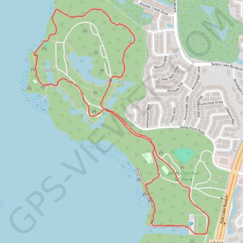
John Chesnut Sr. Park Loop Trail
The John Chesnut Sr. Park Loop Trail offers a scenic and tranquil experience, winding through lush floodplain forests, cypress swamps, and wetlands. Along the path, hikers can enjoy views of Lake Tarpon, observe local wildlife like herons and alligators, and explore boardwalks that traverse marshy areas. The trail provides a peaceful, nature-filled escape with the opportunity to spot various bird species and enjoy the serene surroundings of this beautiful park. #Hiking #Loop #Lake #Forest #Nature
- Distance: 4.5 Km
- Elevation gain: 26 m
- Maximum elevation: 11 m
- Elevation loss: 26 m
- Minimum elevation: 2 m
- Moving time: 57 m 19 s
- Moving speed: 4.7 Km/h
- Maximum speed: 8.5 Km/h
- Total time: 1 h 10 s
- Global speed: 4.5 Km/h
Interactive trail map
Trail profile
- Distance: 4.5 Km
- Elevation gain: 26 m
- Maximum elevation: 11 m
- Elevation loss: 26 m
- Minimum elevation: 2 m
- Moving time: 57 m 19 s
- Moving speed: 4.7 Km/h
- Maximum speed: 8.5 Km/h
- Total time: 1 h 10 s
- Global speed: 4.5 Km/h
About this trail
Name: John Chesnut Sr. Park Loop Trail trail, distance, elevation, map, profile, GPS track
Start: Sandy Point Road, East Lake, Pinellas County, Florida, 34685, United States (28.08940 -82.70350)
End: Sandy Point Road, East Lake, Pinellas County, Florida, 34685, United States (28.08943 -82.70351)
Coordinates: 28.08614 -82.71097 28.09809 -82.70042