Rock Springs Buttress Approach Trail
Teton County Hiking
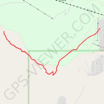
- Distance: 3.9 Km
- Elevation gain: 679 m
- Maximum elevation: 2,683 m
- Elevation loss: 1 m
- Minimum elevation: 2,004 m
Interactive trail map
Trail profile
- Distance: 3.9 Km
- Elevation gain: 679 m
- Maximum elevation: 2,683 m
- Elevation loss: 1 m
- Minimum elevation: 2,004 m
About this trail
Name: Rock Springs Buttress Approach Trail trail, distance, elevation, map, profile, GPS track
Start: Teton Village, Teton County, Wyoming, 83025, United States (43.58684 -110.83951)
End: Rock Spring Loop, Teton Village, Teton County, Wyoming, 83025, United States (43.58624 -110.86967)
Coordinates: 43.57622 -110.86978 43.58684 -110.83951