
Vista Grande and Flag Hill Loop
Loop hike from Alameda Creek to Vista Grande via Flag Hill, Cave Rocks Road, Eagle View Road, Vista Grande Overlook, Vista, Vista Grande Road, High Valley Road and Hayfield Road in the Sunol Regional Wilderness. #Hiking #Loop #Mountain #Nature #Forest #Wilderness
- Distance: 11.8 Km
- Elevation gain: 573 m
- Maximum elevation: 561 m
- Elevation loss: 576 m
- Minimum elevation: 126 m
- Moving time: 4 h 26 m
- Moving speed: 2.6 Km/h
- Maximum speed: 5.3 Km/h
- Total time: 5 h 36 m
- Global speed: 2.1 Km/h
Interactive trail map
Trail profile
- Distance: 11.8 Km
- Elevation gain: 573 m
- Maximum elevation: 561 m
- Elevation loss: 576 m
- Minimum elevation: 126 m
- Moving time: 4 h 26 m
- Moving speed: 2.6 Km/h
- Maximum speed: 5.3 Km/h
- Total time: 5 h 36 m
- Global speed: 2.1 Km/h
About this trail
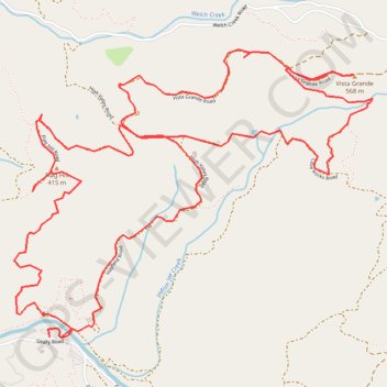
Name: Vista Grande and Flag Hill Loop trail, distance, elevation, map, profile, GPS track
Start: Geary Road, Alameda County, California, United States (37.51559 -121.83191)
End: 1888, Geary Road, Alameda County, California, 94586, United States (37.51558 -121.83110)
Coordinates: 37.51556 -121.83432 37.53118 -121.80987