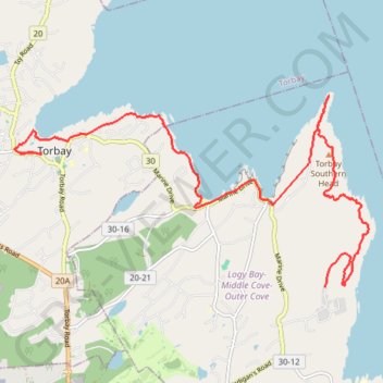
East Coast Trail - Silver Mine Cobbler Path
#Hiking #Newfoundland #Atlantic
- Distance: 14.8 Km
- Elevation gain: 514 m
- Maximum elevation: 189 m
- Elevation loss: 621 m
- Minimum elevation: -1 m
Interactive trail map
Trail profile
- Distance: 14.8 Km
- Elevation gain: 514 m
- Maximum elevation: 189 m
- Elevation loss: 621 m
- Minimum elevation: -1 m
About this trail
Name: East Coast Trail - Silver Mine Cobbler Path trail, distance, elevation, map, profile, GPS track
Coordinates: 47.63841 -52.73533 47.66528 -52.66147