Bung Crag Pagoda Environs
- Distance: 2.1 Km
- Elevation gain: 8 m
- Maximum elevation: 1,112 m
- Elevation loss: 126 m
- Minimum elevation: 989 m
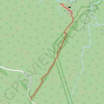
Interactive trail map
Trail profile
- Distance: 2.1 Km
- Elevation gain: 8 m
- Maximum elevation: 1,112 m
- Elevation loss: 126 m
- Minimum elevation: 989 m
About this trail
Name: Bung Crag Pagoda Environs trail, distance, elevation, map, profile, GPS track
Coordinates: -33.43511 150.22653 -33.42033 150.23442
Topography: New South Wales topographic map, elevation, terrain