Thank you for supporting this site ❤️
Make a donation
Make a donation
Gear up for your next adventure:
As an Amazon Associate, this site earns from qualifying purchases at no extra cost to you.
Footscray Meadows Park Loop Run
- Distance: 5.0 Km
- Elevation gain: 49 m
- Maximum elevation: 41 m
- Elevation loss: 50 m
- Minimum elevation: 19 m
- Moving time: 32 m 9 s
- Moving speed: 9.4 Km/h
- Maximum speed: 16.1 Km/h
- Total time: 32 m 9 s
- Global speed: 9.4 Km/h
Interactive trail map
Thank you for supporting this site ❤️
Make a donation
Make a donation
Gear up for your next adventure:
As an Amazon Associate, this site earns from qualifying purchases at no extra cost to you.
Trail profile
- Distance: 5.0 Km
- Elevation gain: 49 m
- Maximum elevation: 41 m
- Elevation loss: 50 m
- Minimum elevation: 19 m
- Moving time: 32 m 9 s
- Moving speed: 9.4 Km/h
- Maximum speed: 16.1 Km/h
- Total time: 32 m 9 s
- Global speed: 9.4 Km/h
Thank you for supporting this site ❤️
Make a donation
Make a donation
Gear up for your next adventure:
As an Amazon Associate, this site earns from qualifying purchases at no extra cost to you.
About this trail
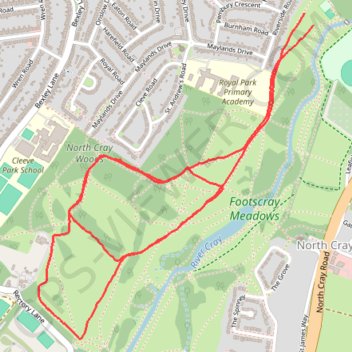
Name: Footscray Meadows Park Loop Run trail, distance, elevation, map, profile, GPS track
Coordinates: 51.42201 0.11922 51.43293 0.13400
Thank you for supporting this site ❤️
Make a donation
Make a donation
Gear up for your next adventure:
As an Amazon Associate, this site earns from qualifying purchases at no extra cost to you.