Import a GPX file

Maligne Lake - Opal Hills Loop

Jasper National Park. #Hiking #Loop #Maligne Lake #OpalHills #Jasper

  • Distance: 7.5 Km
  • Elevation gain: 488 m
  • Maximum elevation: 2,161 m
  • Elevation loss: 491 m
  • Minimum elevation: 1,692 m

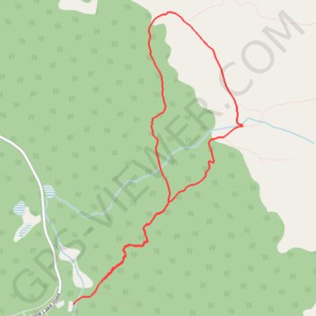
Interactive trail map

Trail profile

  • Distance: 7.5 Km
  • Elevation gain: 488 m
  • Maximum elevation: 2,161 m
  • Elevation loss: 491 m
  • Minimum elevation: 1,692 m

About this trail

Name: Maligne Lake - Opal Hills Loop trail, distance, elevation, map, profile, GPS track

Start: Opal Hills Loop, Improvement District No. 12, Alberta, Canada (52.73285 -117.63070)

End: Mary Schaeffer Loop, Improvement District No. 12, Alberta, Canada (52.73091 -117.63459)

Coordinates: 52.73091 -117.63459 52.75576 -117.61082

Other hiking, mountain biking, running and outdoor activity trails

Click on a trail to view its statistics, map and profile.

Jasper - Jasper National Park

Canada > Alberta > Municipality of Jasper

#Bike #Jasper

Distance: 82.6 Km • Elevation gain: 942 m • Maximum elevation: 1,602 m

Gear up for your next adventure:

📚Map Reading & Navigation Guides - Master the art of interpreting topographic contours and symbols
🦯Adjustable Trekking Poles - Reduce impact on knees when descending steep topographic ridges
🐍Snake Gaiters - Protection against snake bites
🎒Daypacks - Compact backpacks for short hikes
👕UPF 50+ Sun Shirts - Essential protection against the harsh Australian sun during field work

As an Amazon Associate, this site earns from qualifying purchases at no extra cost to you.