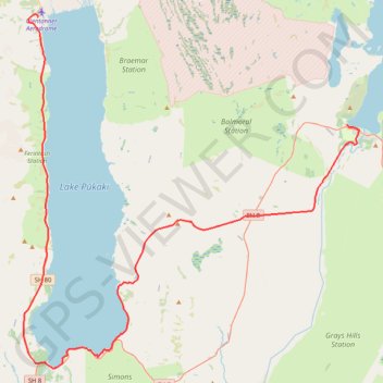
Lake Tekapo - Lake Pukaki - Glenntanner
#Bike
- Distance: 79.8 Km
- Elevation gain: 605 m
- Maximum elevation: 751 m
- Elevation loss: 764 m
- Minimum elevation: 532 m
Interactive trail map
Trail profile
- Distance: 79.8 Km
- Elevation gain: 605 m
- Maximum elevation: 751 m
- Elevation loss: 764 m
- Minimum elevation: 532 m
About this trail
Name: Lake Tekapo - Lake Pukaki - Glenntanner trail, distance, elevation, map, profile, GPS track
Coordinates: -44.19095 170.10816 -43.91216 170.47621
Other hiking, mountain biking, running and outdoor activity trails
Click on a trail to view its statistics, map and profile.
Mount John Walkway loop via Mount John Observatory above Tekapo Lake
New Zealand > Canterbury > Mackenzie District > Lake Tekapo
Distance: 8.2 Km • Elevation gain: 379 m • Maximum elevation: 1,007 m