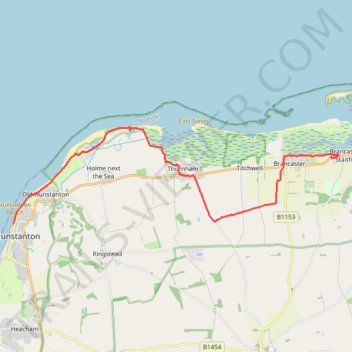
Norfolk Coast Path - Hunstanton to Brancaster Staithe
- Distance: 18.5 Km
- Elevation gain: 113 m
- Maximum elevation: 57 m
- Elevation loss: 114 m
- Minimum elevation: 0 m
- Moving time: 4 h 7 m
- Moving speed: 4.5 Km/h
- Maximum speed: 7.1 Km/h
- Total time: 4 h 42 m
- Global speed: 3.9 Km/h
Interactive trail map
Trail profile
- Distance: 18.5 Km
- Elevation gain: 113 m
- Maximum elevation: 57 m
- Elevation loss: 114 m
- Minimum elevation: 0 m
- Moving time: 4 h 7 m
- Moving speed: 4.5 Km/h
- Maximum speed: 7.1 Km/h
- Total time: 4 h 42 m
- Global speed: 3.9 Km/h
About this trail
Name: Norfolk Coast Path - Hunstanton to Brancaster Staithe trail, distance, elevation, map, profile, GPS track
Coordinates: 52.94334 0.48810 52.97534 0.66685