Mount San Jacinto from Palm Springs Aerial Tramway
Interactive trail map
Trail profile
- Distance: 8.2 Km
- Elevation gain: 734 m
- Maximum elevation: 3,275 m
- Elevation loss: 51 m
- Minimum elevation: 2,557 m
About this trail
Name: Mount San Jacinto from Palm Springs Aerial Tramway trail, distance, elevation, map, profile, GPS track
Start: Round Valley Trail, Riverside County, California, United States (33.81312 -116.63811)
End: Peak Trail, Riverside County, California, United States (33.81448 -116.67918)
Coordinates: 33.79910 -116.67918 33.81503 -116.63811
Other hiking, mountain biking, running and outdoor activity trails
Click on a trail to view its statistics, map and profile.
Pacific Crest Trail (PCT) through San Bernardino Forest and Santa Rosa and San Jacinto Mountains
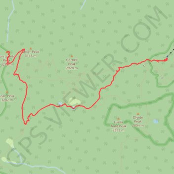
United States > California > Riverside County
Hike from Bull Canyon Parking to Snow Creek along the Pacific Crest National Scenic Trail via Lion Peak, Pyramid Peak, Cedar Spring, Palm View Peak, Fobes Saddle, Spitler Peak, Apache Peak, Apache Spring, Antsell Rock, South Peak, Red Tahquitz, Tahquitz Meadow, Powderbox Spring, Middle Spring, Jolley Spring,…
Distance: 95.0 Km • Elevation gain: 3,982 m • Maximum elevation: 2,737 m
San Jacinto Peak via Palm Springs Aerial Tramway, Round Valley Trail and Peak Trail
United States > California > Riverside County
The hike to San Jacinto Peak is a stunning journey through diverse landscapes, starting with a steep ascent that transitions into tranquil alpine meadows. As you make your way through Round Valley and past Wellman Divide, the trail gradually opens to reveal expansive views of the Coachella Valley and…
Distance: 16.9 Km • Elevation gain: 785 m • Maximum elevation: 3,280 m
Cactus to Clouds
United States > California > Riverside County > Palm Springs
Hike from Palm Springs to San Jacinto Peak by the Skyline Trail, the Grubbs Notch, the Round Valley Trail, the Wellman Divide and the Peak Trail in the Santa Rosa and San Jacinto Mountains National Monument. #Hiking #Mountain #Nature #Forest #Park
Distance: 31.6 Km • Elevation gain: 3,298 m • Maximum elevation: 3,280 m
Mount Jacinto Loop
United States > California > Riverside County > Idyllwild
Loop Hike to Mount Jacinto via Deer Springs Trail, Pacific Crest Trail (PCT), Peak Trail and Wellman's Cienaga Trail in the San Bernardino National Forest and the Mount San Jacinto State Park. #Hiking #Loop #Mountain #Nature #Forest #Park #PCT
Distance: 28.0 Km • Elevation gain: 1,646 m • Maximum elevation: 3,279 m
Willow Creek Trail to Caramba Overlook via Hidden Lake and Round Valley Loop
United States > California > Riverside County
Distance: 17.7 Km • Elevation gain: 886 m • Maximum elevation: 2,675 m