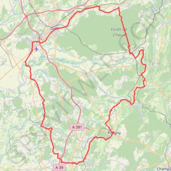
Tour du Jura à vélo loisirs - Dole
- Distance: 155.3 Km
- Elevation gain: 1,205 m
- Maximum elevation: 389 m
- Elevation loss: 1,205 m
- Minimum elevation: 189 m
Interactive trail map
Trail profile
- Distance: 155.3 Km
- Elevation gain: 1,205 m
- Maximum elevation: 389 m
- Elevation loss: 1,205 m
- Minimum elevation: 189 m
About this trail
Name: Tour du Jura à vélo loisirs - Dole trail, distance, elevation, map, profile, GPS track
Coordinates: 46.75584 5.38616 47.14689 5.82496
Other hiking, mountain biking, running and outdoor activity trails
Click on a trail to view its statistics, map and profile.
PT23DS2 Lörrach → Cadaqués
Germany > Baden-Württemberg > Landkreis Lörrach > Lörrach (Kernstadt)
Distance: 1,050.7 Km • Elevation gain: 13,130 m • Maximum elevation: 1,505 m
Riethoven naar Oostenrijk
Netherlands > North Brabant > Riethoven > Eind
Distance: 922.1 Km • Elevation gain: 13,629 m • Maximum elevation: 1,897 m