Day 2: Dispersed to Sacramento Pass BLM Area just west of Baker, NV
Making distance mostly but discovered a super nice small highway between our camp and Austin. 722. Great for bicycles or motorcycles. Or small RVs. Saw exactly zero vehicles in the 40 or so miles until just before Austin. Super.
Note: very good latte shop in Ely called xxx
Camp for tonight is a well developed BLM area maybe 20 miles from Baker, NV. It being Friday evening the few campsites were full but there are plenty of dispersed spots around. Beautiful Milky Way tonight.
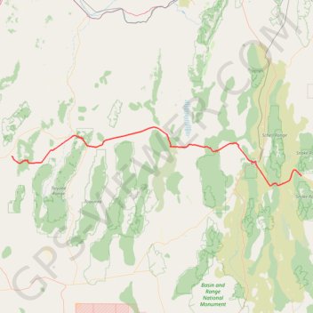
- Distance: 415.6 Km
- Elevation gain: 4,545 m
- Maximum elevation: 2,358 m
- Elevation loss: 4,020 m
- Minimum elevation: 1,561 m
Interactive trail map
Trail profile
- Distance: 415.6 Km
- Elevation gain: 4,545 m
- Maximum elevation: 2,358 m
- Elevation loss: 4,020 m
- Minimum elevation: 1,561 m
About this trail
Name: Day 2: Dispersed to Sacramento Pass BLM Area just west of Baker, NV trail, distance, elevation, map, profile, GPS track
End: Sacramento Pass Trail, White Pine County, Nevada, United States (39.11774 -114.30735)
Coordinates: 39.02079 -117.87944 39.58387 -114.30315