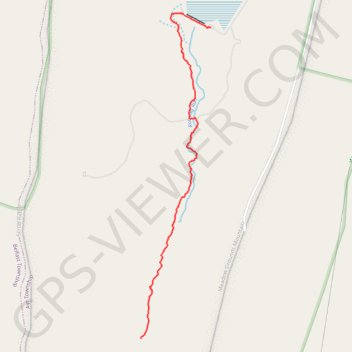
Jarret Falls Trail
- Distance: 2.8 Km
- Elevation gain: 79 m
- Maximum elevation: 460 m
- Elevation loss: 11 m
- Minimum elevation: 391 m
- Moving time: 51 m 42 s
- Moving speed: 3.3 Km/h
- Maximum speed: 9.5 Km/h
- Total time: 55 m 14 s
- Global speed: 3.1 Km/h
Interactive trail map
Trail profile
- Distance: 2.8 Km
- Elevation gain: 79 m
- Maximum elevation: 460 m
- Elevation loss: 11 m
- Minimum elevation: 391 m
- Moving time: 51 m 42 s
- Moving speed: 3.3 Km/h
- Maximum speed: 9.5 Km/h
- Total time: 55 m 14 s
- Global speed: 3.1 Km/h
About this trail
Name: Jarret Falls Trail trail, distance, elevation, map, profile, GPS track
Start: Jarrett Trail, Ayr Township, Fulton County, Pennsylvania, United States (39.88658 -78.06281)
End: Jarrett Trail, Ayr Township, Fulton County, Pennsylvania, United States (39.90491 -78.05746)
Coordinates: 39.88658 -78.06281 39.90573 -78.05746