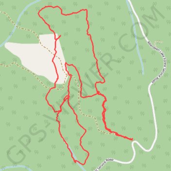
Aberdeen Swamp
- Distance: 5.7 Km
- Elevation gain: 115 m
- Maximum elevation: 1,277 m
- Elevation loss: 115 m
- Minimum elevation: 1,221 m
Interactive trail map
Trail profile
- Distance: 5.7 Km
- Elevation gain: 115 m
- Maximum elevation: 1,277 m
- Elevation loss: 115 m
- Minimum elevation: 1,221 m
About this trail
Name: Aberdeen Swamp trail, distance, elevation, map, profile, GPS track
Coordinates: 50.15615 -119.07980 50.16678 -119.06991
Other hiking, mountain biking, running and outdoor activity trails
Click on a trail to view its statistics, map and profile.
2022 TABG Aberdeen Plateau
Canada > British Columbia > Regional District of North Okanagan > Vernon
Distance: 141.4 Km • Elevation gain: 2,053 m • Maximum elevation: 1,351 m