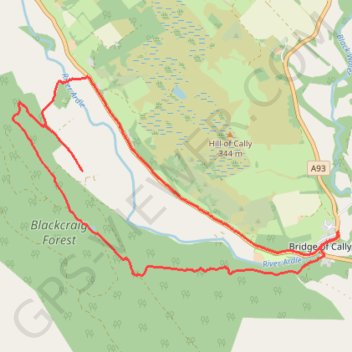
Around Bridge of Cally
- Distance: 13.3 Km
- Elevation gain: 282 m
- Maximum elevation: 293 m
- Elevation loss: 282 m
- Minimum elevation: 157 m
- Moving time: 59 m 19 s
- Moving speed: 13.5 Km/h
- Maximum speed: 32.3 Km/h
- Total time: 1 h 30 m
- Global speed: 8.8 Km/h
Interactive trail map
Trail profile
- Distance: 13.3 Km
- Elevation gain: 282 m
- Maximum elevation: 293 m
- Elevation loss: 282 m
- Minimum elevation: 157 m
- Moving time: 59 m 19 s
- Moving speed: 13.5 Km/h
- Maximum speed: 32.3 Km/h
- Total time: 1 h 30 m
- Global speed: 8.8 Km/h
About this trail
Name: Around Bridge of Cally trail, distance, elevation, map, profile, GPS track
Coordinates: 56.64380 -3.46759 56.66628 -3.40078
Other hiking, mountain biking, running and outdoor activity trails
Click on a trail to view its statistics, map and profile.
Alyth to Spittal of Glenshee - Cateran Trail (some of)
United Kingdom > Scotland > Perth and Kinross > Alyth
Distance: 44.2 Km • Elevation gain: 1,134 m • Maximum elevation: 650 m
Spittal of Glenshee to Alyth - Some of the Cateran Trail
United Kingdom > Scotland > Perth and Kinross > Spittal of Glenshee
Distance: 38.3 Km • Elevation gain: 561 m • Maximum elevation: 459 m