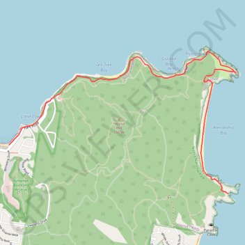
Noosa National Park - Coastal Track
Interactive trail map
Trail profile
- Distance: 11.4 Km
- Elevation gain: 373 m
- Maximum elevation: 37 m
- Elevation loss: 373 m
- Minimum elevation: 0 m
About this trail
Name: Noosa National Park - Coastal Track trail, distance, elevation, map, profile, GPS track
Start: Park Road, Noosa Heads, Noosa Shire, Queensland, 4567, Australia (-26.38666 153.09315)
End: Park Road, Noosa Heads, Noosa Shire, Queensland, 4567, Australia (-26.38666 153.09315)
Coordinates: -26.39172 153.09315 -26.37694 153.11943
Topography: Queensland topographic map, elevation, terrain
Other hiking, mountain biking, running and outdoor activity trails
Click on a trail to view its statistics, map and profile.