Make a donation
Gear up for your next adventure:
As an Amazon Associate, this site earns from qualifying purchases at no extra cost to you.
Dry Fork Narrows, Peek-A-Boo and Spooky Slot Canyons Loop
From the Dry Fork trailhead near Hole-in-the-Rock Road, the route crosses open slickrock and sandy desert benches before dropping into Dry Fork of Coyote Gulch, where the broad wash leads toward the smooth, shadowed corridors of Dry Fork Narrows. This Scorpion Wilderness Study Area hike sits within Grand Staircase-Escalante National Monument and links dry desert terrain with sculpted Navajo Sandstone passages.
After the narrows, the itinerary reaches Peek-A-Boo Gulch, a tighter and more playful slot with polished pockets, small arches, and short rock steps, then crosses an open slickrock-and-sand connector toward Spooky Gulch. Spooky forms the most enclosed part of the loop, with twisting walls, a darker hallway-like feel, and polished bends that contrast sharply with the brighter wash outside.
The return follows the Dry Fork wash back toward the central canyon junction, then climbs out through the same desert benches to the trailhead. Overall, this compact loop offers a vivid sequence of open high-desert views, Dry Fork Narrows, Peek-A-Boo Gulch, Spooky Gulch, and the sandy exit wash in one varied canyonland circuit.
#Hiking #Nature #Loop #Canyon #Slot #Desert #Sandstone #Slickrock #Narrows #Wilderness
- Distance: 9.7 Km
- Elevation gain: 222 m
- Maximum elevation: 1,517 m
- Elevation loss: 222 m
- Minimum elevation: 1,423 m
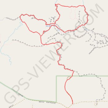
Interactive trail map
Make a donation
Gear up for your next adventure:
As an Amazon Associate, this site earns from qualifying purchases at no extra cost to you.
Trail profile
- Distance: 9.7 Km
- Elevation gain: 222 m
- Maximum elevation: 1,517 m
- Elevation loss: 222 m
- Minimum elevation: 1,423 m
Make a donation
Gear up for your next adventure:
As an Amazon Associate, this site earns from qualifying purchases at no extra cost to you.
About this trail
Name: Dry Fork Narrows, Peek-A-Boo and Spooky Slot Canyons Loop trail, distance, elevation, map, profile, GPS track
Coordinates: 37.46559 -111.22555 37.48556 -111.20837
Make a donation
Gear up for your next adventure:
As an Amazon Associate, this site earns from qualifying purchases at no extra cost to you.
Other hiking, mountain biking, running and outdoor activity trails
Click on a trail to view its statistics, map and profile.
Spooky Slot Canyon and Peek-A-Boo Slot Canyon Loop Trail
United States > Utah > Kane County
The Peek-A-Boo and Spooky Slot Canyons Loop Trail offers a fascinating, though physically challenging, hiking experience in the Grand Staircase-Escalante National Monument. Hikers are treated to dramatic, narrow passages through the slot canyons, with Peek-A-Boo presenting impressive rock formations and a…
Distance: 4.7 Km • Elevation gain: 156 m • Maximum elevation: 1,512 m
Peek-a-Boo Slot Canyon, Spooky Slot Canyon and Dry Fork Narrows Loop
United States > Utah > Kane County
Loop hike via Lower Dry Fork Trail, Peek-a-Boo Slot Canyon, Spooky Slot Canyon, Dry Fork Coyote Gulch Trail and Dry Fork Narrows Trail in the Scorpion Wilderness Study Area and the Grand Staircase-Escalante National Monument. #Hiking #Loop #Canyon #Nature #Wilderness
Distance: 5.9 Km • Elevation gain: 167 m • Maximum elevation: 1,512 m