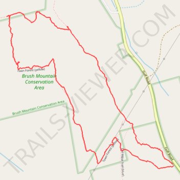
Town Forest Loop in Brush Mountain Conservation Area
- Distance: 3.5 Km
- Elevation gain: 90 m
- Maximum elevation: 405 m
- Elevation loss: 90 m
- Minimum elevation: 324 m
- Moving time: 1 h 12 m
- Moving speed: 2.9 Km/h
- Maximum speed: 16.5 Km/h
- Total time: 1 h 42 m
- Global speed: 2.0 Km/h
Interactive trail map
Trail profile
- Distance: 3.5 Km
- Elevation gain: 90 m
- Maximum elevation: 405 m
- Elevation loss: 90 m
- Minimum elevation: 324 m
- Moving time: 1 h 12 m
- Moving speed: 2.9 Km/h
- Maximum speed: 16.5 Km/h
- Total time: 1 h 42 m
- Global speed: 2.0 Km/h
About this trail
Name: Town Forest Loop in Brush Mountain Conservation Area trail, distance, elevation, map, profile, GPS track
Coordinates: 42.65939 -72.43014 42.66702 -72.41912