Import a GPX file

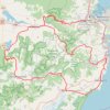
Bowral Loop

#Bike #Loop

  • Distance: 158.9 Km
  • Elevation gain: 2,111 m
  • Maximum elevation: 824 m
  • Elevation loss: 2,125 m
  • Minimum elevation: 371 m

Interactive trail map

Trail profile

  • Distance: 158.9 Km
  • Elevation gain: 2,111 m
  • Maximum elevation: 824 m
  • Elevation loss: 2,125 m
  • Minimum elevation: 371 m

About this trail

Other hiking, mountain biking, running and outdoor activity trails

Click on a trail to view its statistics, map and profile.

Alexandra Lake - Mount Alexandra - Katoomba Lookout

Australia > New South Wales > Mittagong

#Hiking #Loop #Alexandra #Katoomba #Mittagong

Distance: 9.3 Km • Elevation gain: 349 m • Maximum elevation: 789 m

Jellore State Forest Loop

Australia > New South Wales

#Hiking #MTB #Loop #Jellore

Distance: 10.3 Km • Elevation gain: 338 m • Maximum elevation: 763 m

Albion Park Loop

Australia > New South Wales > Albion Park

#Bike #Loop

Distance: 163.6 Km • Elevation gain: 3,516 m • Maximum elevation: 771 m

Shell Cove - Duffy

Australia > New South Wales

#Bike #Canberra

Distance: 292.2 Km • Elevation gain: 3,534 m • Maximum elevation: 872 m

Shell Cove - Tallowa Dam

Australia > New South Wales

#Bike #Loop

Distance: 206.2 Km • Elevation gain: 3,526 m • Maximum elevation: 773 m

Gear up for your next adventure:

📱Tablet Tripod Mounts - Steady platforms for viewing digital maps or taking long exposures
🔪Outdoor Multi-tools - Versatile tools for gear repair and survival tasks in the wilderness
🛰️Handheld GPS Units - Rugged GPS devices for tracking coordinates and elevation in the Australian bush
🎒Daypacks - Compact backpacks for short hikes
⌚Altimeter Barometer Watches - Outdoor watches with built-in sensors to track altitude changes and weather shifts

As an Amazon Associate, this site earns from qualifying purchases at no extra cost to you.