Miskolc
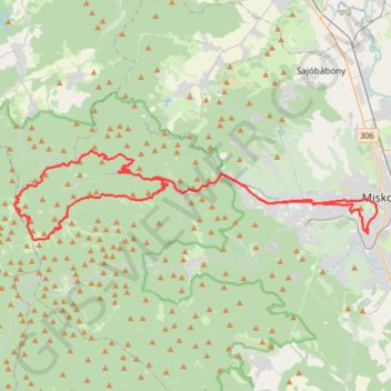
Loop from Miskolc.
- Distance: 69.3 Km
- Elevation gain: 1,240 m
- Maximum elevation: 898 m
- Elevation loss: 1,241 m
- Minimum elevation: 133 m
- Moving time: 2 h 33 m
- Moving speed: 27.0 Km/h
- Maximum speed: 38.9 Km/h
- Total time: 2 h 33 m
- Global speed: 27.0 Km/h
Interactive trail map
Trail profile
- Distance: 69.3 Km
- Elevation gain: 1,240 m
- Maximum elevation: 898 m
- Elevation loss: 1,241 m
- Minimum elevation: 133 m
- Moving time: 2 h 33 m
- Moving speed: 27.0 Km/h
- Maximum speed: 38.9 Km/h
- Total time: 2 h 33 m
- Global speed: 27.0 Km/h
About this trail
Name: Miskolc trail, distance, elevation, map, profile, GPS track
Coordinates: 48.07916 20.48066 48.12921 20.78570