Import a GPX file

Queen Elizabeth II Wildlands Provincial Park

#Hiking #Loop #Elizabeth

  • Distance: 12.6 Km
  • Elevation gain: 95 m
  • Maximum elevation: 263 m
  • Elevation loss: 94 m
  • Minimum elevation: 242 m

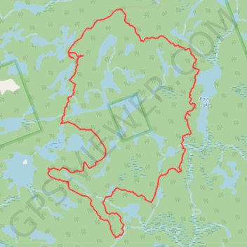
Interactive trail map

Trail profile

  • Distance: 12.6 Km
  • Elevation gain: 95 m
  • Maximum elevation: 263 m
  • Elevation loss: 94 m
  • Minimum elevation: 242 m

About this trail

Name: Queen Elizabeth II Wildlands Provincial Park trail, distance, elevation, map, profile, GPS track

Start: Kawartha Lakes, Central Ontario, Ontario, Canada (44.77878 -79.11452)

End: Kawartha Lakes, Central Ontario, Ontario, Canada (44.77875 -79.11451)

Coordinates: 44.75058 -79.12732 44.77878 -79.10103

Other hiking, mountain biking, running and outdoor activity trails

Click on a trail to view its statistics, map and profile.

Québec - Montréal - Saint-Laurent River - Lake Ontario - Niagara Falls

Canada > Quebec > Urban agglomeration of Québec > Quebec

#Bike #Ontario

Distance: 1,078.4 Km • Elevation gain: 4,804 m • Maximum elevation: 209 m

Gear up for your next adventure:

📡Satellite Messengers - Emergency communication devices
🚁Camera Drones with GPS - Capture aerial views of the landscape to compare with topo maps
🚴Bike GPS - GPS devices for cycling
🧭Compass - Navigation compasses for outdoor exploration
🛌Compact Down Sleeping Bags - Warmth without the bulk, ideal for backcountry camping

As an Amazon Associate, this site earns from qualifying purchases at no extra cost to you.