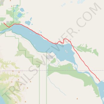
Knik Glacier Trail
- Distance: 32.2 Km
- Elevation gain: 169 m
- Maximum elevation: 81 m
- Elevation loss: 108 m
- Minimum elevation: 13 m
- Moving time: 4 d 9 h
- Moving speed: 0.3 Km/h
- Maximum speed: 0.1 Km/h
- Total time: 13 d 10 h
- Global speed: 0.1 Km/h
Interactive trail map
Trail profile
- Distance: 32.2 Km
- Elevation gain: 169 m
- Maximum elevation: 81 m
- Elevation loss: 108 m
- Minimum elevation: 13 m
- Moving time: 4 d 9 h
- Moving speed: 0.3 Km/h
- Maximum speed: 0.1 Km/h
- Total time: 13 d 10 h
- Global speed: 0.1 Km/h
About this trail
Name: Knik Glacier Trail trail, distance, elevation, map, profile, GPS track
Coordinates: 61.40408 -149.00652 61.52717 -148.58542
Other hiking, mountain biking, running and outdoor activity trails
Click on a trail to view its statistics, map and profile.
Road Trip Alaska 2018
United States > Alaska > Anchorage
From Anchorage.
Distance: 641.7 Km • Elevation gain: 4,791 m • Maximum elevation: 739 m