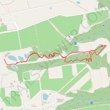
Element Mont Marie
- Distance: 3.0 Km
- Elevation gain: 99 m
- Maximum elevation: 262 m
- Elevation loss: 103 m
- Minimum elevation: 161 m
- Moving time: 21 m 25 s
- Moving speed: 8.4 Km/h
- Maximum speed: 26.1 Km/h
- Total time: 32 m 4 s
- Global speed: 5.6 Km/h
Interactive trail map
Trail profile
- Distance: 3.0 Km
- Elevation gain: 99 m
- Maximum elevation: 262 m
- Elevation loss: 103 m
- Minimum elevation: 161 m
- Moving time: 21 m 25 s
- Moving speed: 8.4 Km/h
- Maximum speed: 26.1 Km/h
- Total time: 32 m 4 s
- Global speed: 5.6 Km/h
About this trail
Name: Element Mont Marie trail, distance, elevation, map, profile, GPS track
Coordinates: -33.98313 18.87159 -33.98130 18.88298
Other hiking, mountain biking, running and outdoor activity trails
Click on a trail to view its statistics, map and profile.
Stellenbosch Ride
South Africa > Western Cape > Cape Winelands District Municipality > Stellenbosch Local Municipality > Stellenbosch
Distance: 50.8 Km • Elevation gain: 1,358 m • Maximum elevation: 351 m