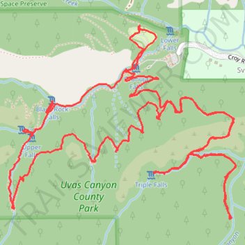
Uvas Canyon Trail, Contour Trail and Waterfall Trail
- Distance: 9.7 Km
- Elevation gain: 679 m
- Maximum elevation: 578 m
- Elevation loss: 679 m
- Minimum elevation: 332 m
- Moving time: 2 h 44 m
- Moving speed: 3.6 Km/h
- Maximum speed: 47.2 Km/h
- Total time: 3 h 40 m
- Global speed: 2.6 Km/h
Interactive trail map
Trail profile
- Distance: 9.7 Km
- Elevation gain: 679 m
- Maximum elevation: 578 m
- Elevation loss: 679 m
- Minimum elevation: 332 m
- Moving time: 2 h 44 m
- Moving speed: 3.6 Km/h
- Maximum speed: 47.2 Km/h
- Total time: 3 h 40 m
- Global speed: 2.6 Km/h
About this trail
Name: Uvas Canyon Trail, Contour Trail and Waterfall Trail trail, distance, elevation, map, profile, GPS track
Start: 12, Uvas Creek Trail, Sveadal, Santa Clara County, California, United States (37.08597 -121.79520)
Coordinates: 37.07599 -121.80365 37.08608 -121.78880