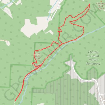
Christmas Rocks trails
- Distance: 5.9 Km
- Elevation gain: 181 m
- Maximum elevation: 363 m
- Elevation loss: 180 m
- Minimum elevation: 288 m
- Moving time: 1 h 15 m
- Moving speed: 4.7 Km/h
- Maximum speed: 11.1 Km/h
- Total time: 1 h 33 m
- Global speed: 3.8 Km/h
Interactive trail map
Trail profile
- Distance: 5.9 Km
- Elevation gain: 181 m
- Maximum elevation: 363 m
- Elevation loss: 180 m
- Minimum elevation: 288 m
- Moving time: 1 h 15 m
- Moving speed: 4.7 Km/h
- Maximum speed: 11.1 Km/h
- Total time: 1 h 33 m
- Global speed: 3.8 Km/h
About this trail
Name: Christmas Rocks trails trail, distance, elevation, map, profile, GPS track
Coordinates: 39.64387 -82.64607 39.65908 -82.63081