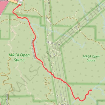
Elsmere Canyon Trail
- Distance: 4.7 Km
- Elevation gain: 97 m
- Maximum elevation: 510 m
- Elevation loss: 99 m
- Minimum elevation: 440 m
- Moving time: 1 h 8 m
- Moving speed: 4.1 Km/h
- Maximum speed: 25.8 Km/h
- Total time: 1 h 24 m
- Global speed: 3.3 Km/h
Interactive trail map
Trail profile
- Distance: 4.7 Km
- Elevation gain: 97 m
- Maximum elevation: 510 m
- Elevation loss: 99 m
- Minimum elevation: 440 m
- Moving time: 1 h 8 m
- Moving speed: 4.1 Km/h
- Maximum speed: 25.8 Km/h
- Total time: 1 h 24 m
- Global speed: 3.3 Km/h
About this trail
Name: Elsmere Canyon Trail trail, distance, elevation, map, profile, GPS track
Coordinates: 34.35155 -118.50213 34.36436 -118.48948
Other hiking, mountain biking, running and outdoor activity trails
Click on a trail to view its statistics, map and profile.
The Beast - Whitney Canyon Park
United States > California > Los Angeles County > Santa Clarita
Distance: 8.3 Km • Elevation gain: 390 m • Maximum elevation: 799 m