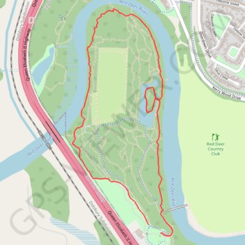
Heritage Ranch Loop
Red Deer River. #Hiking #Snowshoeing #Running #Loop
- Distance: 4.5 Km
- Elevation gain: 60 m
- Maximum elevation: 886 m
- Elevation loss: 61 m
- Minimum elevation: 857 m
Interactive trail map
Trail profile
- Distance: 4.5 Km
- Elevation gain: 60 m
- Maximum elevation: 886 m
- Elevation loss: 61 m
- Minimum elevation: 857 m
About this trail
Name: Heritage Ranch Loop trail, distance, elevation, map, profile, GPS track
Start: Heritage Ranch Trail, Red Deer, Alberta, T4N 1E3, Canada (52.26254 -113.85312)
End: Heritage Ranch Trail, Red Deer, Alberta, T4N 1E3, Canada (52.26201 -113.85190)
Coordinates: 52.26184 -113.86105 52.27627 -113.85061