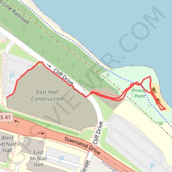
Prince's Point
- Distance: 0.6 Km
- Elevation gain: 20 m
- Maximum elevation: 212 m
- Elevation loss: 29 m
- Minimum elevation: 182 m
- Moving time: 8 m 24 s
- Moving speed: 4.0 Km/h
- Maximum speed: 6.0 Km/h
- Total time: 8 m 59 s
- Global speed: 3.7 Km/h
Interactive trail map
Trail profile
- Distance: 0.6 Km
- Elevation gain: 20 m
- Maximum elevation: 212 m
- Elevation loss: 29 m
- Minimum elevation: 182 m
- Moving time: 8 m 24 s
- Moving speed: 4.0 Km/h
- Maximum speed: 6.0 Km/h
- Total time: 8 m 59 s
- Global speed: 3.7 Km/h
About this trail
Name: Prince's Point trail, distance, elevation, map, profile, GPS track
Start: 5, Cliff Drive, Houghton, Houghton County, Michigan, 49931, United States (47.11702 -88.54116)
Coordinates: 47.11684 -88.54116 47.11757 -88.53758