Grand Prismatic Spring Overlook via Fairy Falls Trail in Yellowstone National Park
Hiking the Fairy Falls Trail to the Grand Prismatic Spring Overlook offers a lovely journey through Yellowstone's stunning landscape, with the final climb leading to breathtaking views of the vibrant hot spring below. It’s a rewarding experience that beautifully showcases the park's unique geothermal wonders. #Hiking #Lake #Forest #Nature
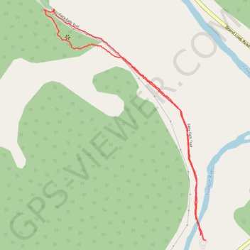
- Distance: 2.8 Km
- Elevation gain: 51 m
- Maximum elevation: 2,248 m
- Elevation loss: 51 m
- Minimum elevation: 2,209 m
- Moving time: 47 m 48 s
- Moving speed: 3.5 Km/h
- Maximum speed: 6.2 Km/h
- Total time: 54 m 20 s
- Global speed: 3.1 Km/h
Interactive trail map
Trail profile
- Distance: 2.8 Km
- Elevation gain: 51 m
- Maximum elevation: 2,248 m
- Elevation loss: 51 m
- Minimum elevation: 2,209 m
- Moving time: 47 m 48 s
- Moving speed: 3.5 Km/h
- Maximum speed: 6.2 Km/h
- Total time: 54 m 20 s
- Global speed: 3.1 Km/h
About this trail
Name: Grand Prismatic Spring Overlook via Fairy Falls Trail in Yellowstone National Park trail, distance, elevation, map, profile, GPS track
Start: Fountain Flats Drive, Teton County, Wyoming, United States (44.51564 -110.83263)
End: Fountain Flats Drive, Teton County, Wyoming, United States (44.51543 -110.83233)
Coordinates: 44.51543 -110.84141 44.52467 -110.83233