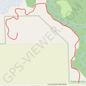
Middle Fork River County Forest Preserve
- Distance: 2.0 Km
- Elevation gain: 6 m
- Maximum elevation: 220 m
- Elevation loss: 9 m
- Minimum elevation: 213 m
- Moving time: 57 m 17 s
- Moving speed: 2.1 Km/h
- Maximum speed: 3.7 Km/h
- Total time: 1 h 8 m
- Global speed: 1.8 Km/h
Interactive trail map
Trail profile
- Distance: 2.0 Km
- Elevation gain: 6 m
- Maximum elevation: 220 m
- Elevation loss: 9 m
- Minimum elevation: 213 m
- Moving time: 57 m 17 s
- Moving speed: 2.1 Km/h
- Maximum speed: 3.7 Km/h
- Total time: 1 h 8 m
- Global speed: 1.8 Km/h
About this trail
Name: Middle Fork River County Forest Preserve trail, distance, elevation, map, profile, GPS track
Start: Point Pleasant Trail, Champaign County, Illinois, United States (40.36365 -87.96141)
End: Point Pleasant Trail, Champaign County, Illinois, United States (40.36810 -87.96855)
Coordinates: 40.36365 -87.96988 40.37075 -87.96120