מסלול חדש ומטורף. אהבתי.
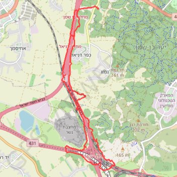
- Distance: 20.3 Km
- Elevation gain: 284 m
- Maximum elevation: 142 m
- Elevation loss: 280 m
- Minimum elevation: 67 m
Interactive trail map
Trail profile
- Distance: 20.3 Km
- Elevation gain: 284 m
- Maximum elevation: 142 m
- Elevation loss: 280 m
- Minimum elevation: 67 m
About this trail
Name: מסלול חדש ומטורף. אהבתי. trail, distance, elevation, map, profile, GPS track
Coordinates: 31.89526 34.92537 31.94923 34.94580
Other hiking, mountain biking, running and outdoor activity trails
Click on a trail to view its statistics, map and profile.
Ben Shemen Hertzel Blue Single
סינגל כחול משודרג ביער בן שמן
Distance: 10.9 Km • Elevation gain: 197 m • Maximum elevation: 176 m