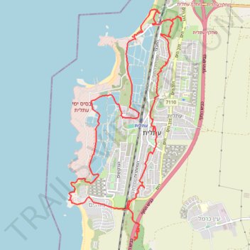
Historical trail run around Atlit
- Distance: 16.4 Km
- Elevation gain: 97 m
- Maximum elevation: 28 m
- Elevation loss: 97 m
- Minimum elevation: -1 m
- Moving time: 2 h 24 m
- Moving speed: 6.8 Km/h
- Maximum speed: 13.9 Km/h
- Total time: 2 h 30 m
- Global speed: 6.6 Km/h
Interactive trail map
Trail profile
- Distance: 16.4 Km
- Elevation gain: 97 m
- Maximum elevation: 28 m
- Elevation loss: 97 m
- Minimum elevation: -1 m
- Moving time: 2 h 24 m
- Moving speed: 6.8 Km/h
- Maximum speed: 13.9 Km/h
- Total time: 2 h 30 m
- Global speed: 6.6 Km/h
About this trail
Name: Historical trail run around Atlit trail, distance, elevation, map, profile, GPS track
Coordinates: 32.67347 34.92645 32.71043 34.94794