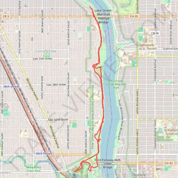
Winchell trail, Minneapolis, MN
- Distance: 9.8 Km
- Elevation gain: 139 m
- Maximum elevation: 252 m
- Elevation loss: 137 m
- Minimum elevation: 229 m
- Moving time: 2 h 2 m
- Moving speed: 4.8 Km/h
- Maximum speed: 11.4 Km/h
- Total time: 2 h 6 m
- Global speed: 4.6 Km/h
Interactive trail map
Trail profile
- Distance: 9.8 Km
- Elevation gain: 139 m
- Maximum elevation: 252 m
- Elevation loss: 137 m
- Minimum elevation: 229 m
- Moving time: 2 h 2 m
- Moving speed: 4.8 Km/h
- Maximum speed: 11.4 Km/h
- Total time: 2 h 6 m
- Global speed: 4.6 Km/h
About this trail
Name: Winchell trail, Minneapolis, MN trail, distance, elevation, map, profile, GPS track
Coordinates: 44.91619 -93.21088 44.95033 -93.20232