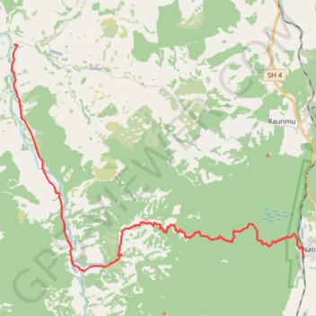
Fishers Track
- Distance: 27.5 Km
- Elevation gain: 425 m
- Maximum elevation: 850 m
- Elevation loss: 1,020 m
- Minimum elevation: 195 m
- Moving time: 1 h 25 m
- Moving speed: 19.3 Km/h
- Maximum speed: 44.4 Km/h
- Total time: 1 h 34 m
- Global speed: 17.4 Km/h
Interactive trail map
Trail profile
- Distance: 27.5 Km
- Elevation gain: 425 m
- Maximum elevation: 850 m
- Elevation loss: 1,020 m
- Minimum elevation: 195 m
- Moving time: 1 h 25 m
- Moving speed: 19.3 Km/h
- Maximum speed: 44.4 Km/h
- Total time: 1 h 34 m
- Global speed: 17.4 Km/h
About this trail
Name: Fishers Track trail, distance, elevation, map, profile, GPS track
End: Oio Road, Ruapehu District, Manawatū-Whanganui, 3990, New Zealand (-39.09277 175.24788)
Coordinates: -39.18154 175.24658 -39.09275 175.39388
Other hiking, mountain biking, running and outdoor activity trails
Click on a trail to view its statistics, map and profile.
Fishers Track
New Zealand > Manawatū-Whanganui > Ruapehu District > National Park
Distance: 27.5 Km • Elevation gain: 426 m • Maximum elevation: 850 m