Ekblom Trail, Maah Daah Hey Trail and Big Plateau Trail Loop in Theodore Roosevelt National Park
This loop offers a dynamic hiking experience through Theodore Roosevelt National Park's diverse landscapes. Hikers can expect expansive views of the park’s rugged badlands, rolling prairies, and the winding Little Missouri River. Along the way, visitors may encounter a variety of wildlife, from prairie dogs and mule deer to bison and wild horses, with the Big Plateau section providing the most expansive, panoramic vistas. The terrain varies, from relatively flat prairies to the steep climbs leading up to the plateau, making for a challenging yet rewarding journey. #Hiking #Loop #Overlook #River #Nature
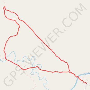
- Distance: 8.4 Km
- Elevation gain: 171 m
- Maximum elevation: 815 m
- Elevation loss: 171 m
- Minimum elevation: 681 m
- Moving time: 1 h 56 m
- Moving speed: 4.3 Km/h
- Maximum speed: 9.3 Km/h
- Total time: 1 h 59 m
- Global speed: 4.2 Km/h
Interactive trail map
Trail profile
- Distance: 8.4 Km
- Elevation gain: 171 m
- Maximum elevation: 815 m
- Elevation loss: 171 m
- Minimum elevation: 681 m
- Moving time: 1 h 56 m
- Moving speed: 4.3 Km/h
- Maximum speed: 9.3 Km/h
- Total time: 1 h 59 m
- Global speed: 4.2 Km/h
About this trail
Name: Ekblom Trail, Maah Daah Hey Trail and Big Plateau Trail Loop in Theodore Roosevelt National Park trail, distance, elevation, map, profile, GPS track
Start: Lone Tree Trail, Billings County, North Dakota, United States (46.95914 -103.50438)
End: Lone Tree Trail, Billings County, North Dakota, United States (46.95931 -103.50501)
Coordinates: 46.95914 -103.53670 46.97954 -103.50438