Import a GPX file

Telescope Peak

Hike from Mahogany Flat Campground to the Telescope Peak in the Death Valley National Park. #Hiking #Mountain #Nature #Park #Forest

  • Distance: 9.9 Km
  • Elevation gain: 949 m
  • Maximum elevation: 3,357 m
  • Elevation loss: 69 m
  • Minimum elevation: 2,476 m

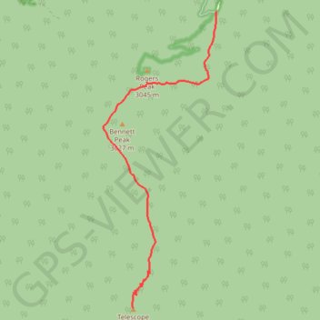
Interactive trail map

Trail profile

  • Distance: 9.9 Km
  • Elevation gain: 949 m
  • Maximum elevation: 3,357 m
  • Elevation loss: 69 m
  • Minimum elevation: 2,476 m

About this trail

Name: Telescope Peak trail, distance, elevation, map, profile, GPS track

Start: Rogers Peak Service Road, Inyo County, California, United States (36.22977 -117.06827)

End: Telescope Peak Trail, Inyo County, California, United States (36.17003 -117.08924)

Coordinates: 36.17003 -117.09654 36.22977 -117.06827

👉 Easily get elevation data in JSON, GeoTIFF and KML formats using Elevation API
Thank you for supporting this site ❤️
Make a donation

Gear up for your next adventure:

As an Amazon Associate, this site earns from qualifying purchases at no extra cost to you.

Gear up for your next adventure:

🚴Bike GPS - GPS devices for cycling
🛌Sleeping Bags - Sleeping bags for outdoor camping
🧥Down Jackets - Insulated jackets for cold weather
Ultralight Solo Tents - Compact shelters for multi-day topographic surveying expeditions
🔌Fast Charging Adapters - Quickly top up all your gear before heading back into the field

As an Amazon Associate, this site earns from qualifying purchases at no extra cost to you.