Wawona Point (Mariposa Grove)
Loop hike through Mariposa Grove to Wawona Point via Big Trees Trail, Fallen Monarch, Bachelor and Three Graces, Grizzly Giant, California Tunnel Tree, Telescope Tree, Fallen Tunnel Tree, Columbia Tree, Clothespin Tree and Faithful Couple Tree In Yosemite National Park. #Hiking #Loop #Mountain #Forest #Nature #Park #Yosemite
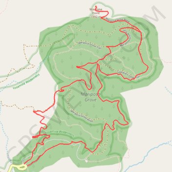
- Distance: 10.3 Km
- Elevation gain: 410 m
- Maximum elevation: 2,060 m
- Elevation loss: 409 m
- Minimum elevation: 1,726 m
Interactive trail map
Trail profile
- Distance: 10.3 Km
- Elevation gain: 410 m
- Maximum elevation: 2,060 m
- Elevation loss: 409 m
- Minimum elevation: 1,726 m
About this trail
Name: Wawona Point (Mariposa Grove) trail, distance, elevation, map, profile, GPS track
Start: Grove Arrival Area, Mariposa County, California, United States (37.50145 -119.61057)
End: Grove Arrival Area, Mariposa County, California, United States (37.50163 -119.61100)
Coordinates: 37.50145 -119.61100 37.51888 -119.59392
Other hiking, mountain biking, running and outdoor activity trails
Click on a trail to view its statistics, map and profile.
Grizzly Giant Loop Trail in Yosemite National Park
United States > California > Mariposa County
The Grizzly Giant Loop Trail in Yosemite's Mariposa Grove offers a relatively short yet captivating hike through some of the world's most magnificent giant sequoias. Along the route, hikers will encounter the iconic Grizzly Giant, an awe-inspiring tree over 2,700 years old and nearly 30 feet wide at its base.…
Distance: 3.3 Km • Elevation gain: 118 m • Maximum elevation: 1,824 m
Mariposa Grove of Giant Sequoias Trail in Yosemite National Park
United States > California > Mariposa County
The Mariposa Grove of Giant Sequoias Trail offers a remarkable hiking experience through one of the largest and oldest groves of sequoia trees in Yosemite National Park. Starting from the Fallen Monarch, visitors are greeted by the impressive root system of this long-fallen sequoia. As you walk along the…
Distance: 11.1 Km • Elevation gain: 372 m • Maximum elevation: 2,060 m