Upper Newport Bay Nature Preserve
Interactive trail map
Trail profile
- Distance: 4.7 Km
- Elevation gain: 64 m
- Maximum elevation: 23 m
- Elevation loss: 64 m
- Minimum elevation: 2 m
About this trail
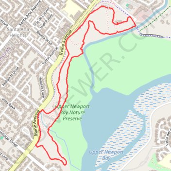
Name: Upper Newport Bay Nature Preserve trail, distance, elevation, map, profile, GPS track
Coordinates: 33.64140 -117.89380 33.65466 -117.88378
Other hiking, mountain biking, running and outdoor activity trails
Click on a trail to view its statistics, map and profile.
Bike ride on Santa Ana river trail to beach
United States > California > Orange County > Anaheim
Distance: 39.5 Km • Elevation gain: 77 m • Maximum elevation: 95 m