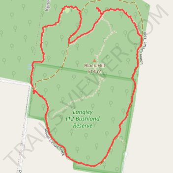
Black Hill Loop Trail, Kyneton
- Distance: 4.5 Km
- Elevation gain: 90 m
- Maximum elevation: 569 m
- Elevation loss: 89 m
- Minimum elevation: 522 m
- Moving time: 1 h 25 m
- Moving speed: 3.2 Km/h
- Maximum speed: 7.3 Km/h
- Total time: 1 h 50 m
- Global speed: 2.5 Km/h
Interactive trail map
Trail profile
- Distance: 4.5 Km
- Elevation gain: 90 m
- Maximum elevation: 569 m
- Elevation loss: 89 m
- Minimum elevation: 522 m
- Moving time: 1 h 25 m
- Moving speed: 3.2 Km/h
- Maximum speed: 7.3 Km/h
- Total time: 1 h 50 m
- Global speed: 2.5 Km/h
About this trail
Name: Black Hill Loop Trail, Kyneton trail, distance, elevation, map, profile, GPS track
Coordinates: -37.19164 144.48347 -37.18037 144.49326
Topography: Victoria topographic map, elevation, terrain