
Tinderbox Circuit
Interactive trail map
Trail profile
- Distance: 17.9 Km
- Elevation gain: 427 m
- Maximum elevation: 138 m
- Elevation loss: 424 m
- Minimum elevation: 0 m
About this trail
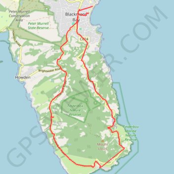
Name: Tinderbox Circuit trail, distance, elevation, map, profile, GPS track
Start: Ocean Esplanade, Blackmans Bay, Hobart, Kingborough, Tasmania, 7052, Australia (-43.00112 147.32599)
Coordinates: -43.05757 147.30544 -43.00112 147.34132
Topography: Hobart topographic map, elevation, terrain