Import a GPX file

Carnarvon Gorge - Big Bend to Gadds

#Hiking #Carnarvon

  • Distance: 15.4 Km
  • Elevation gain: 723 m
  • Maximum elevation: 1,103 m
  • Elevation loss: 456 m
  • Minimum elevation: 506 m

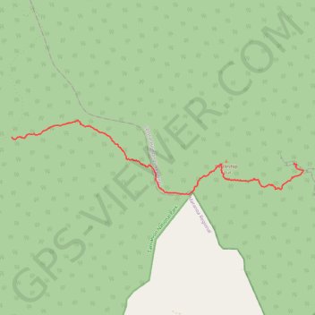
Interactive trail map

Trail profile

  • Distance: 15.4 Km
  • Elevation gain: 723 m
  • Maximum elevation: 1,103 m
  • Elevation loss: 456 m
  • Minimum elevation: 506 m

About this trail

Name: Carnarvon Gorge - Big Bend to Gadds trail, distance, elevation, map, profile, GPS track

Start: Main Gorge Walk, Carnarvon Park, Central Highlands Regional, Queensland, Australia (-25.03410 148.17043)

End: Carnarvon Great Walk, Mount Moffatt, Maranoa Regional, Queensland, Australia (-25.02527 148.07009)

Coordinates: -25.04385 148.07004 -25.02006 148.17375

Topography: Queensland topographic map, elevation, terrain

Other hiking, mountain biking, running and outdoor activity trails

Click on a trail to view its statistics, map and profile.

Big Bend Walk - Carnarvon Upper Gorge

Australia > Queensland

Carnarvon National Park. #Hiking #Carnarvon

Distance: 21.3 Km • Elevation gain: 705 m • Maximum elevation: 589 m

Gear up for your next adventure:

📻Handheld UHF Radios - Critical communication for groups in the Australian outback
🪢550 Survival Paracord - Versatile cordage for gear repair and emergency lashing
🧊Insulated Stainless Steel Flasks - Keep water cold for 24 hours in the heat or coffee hot in the cold
🩹Blister Prevention Tape - Apply to friction points before they become painful sores
🧦Hiking Socks - Comfortable socks for long hikes

As an Amazon Associate, this site earns from qualifying purchases at no extra cost to you.