Paparoa Track and Pike 29
Cycling
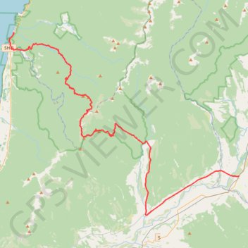
- Distance: 69.2 Km
- Elevation gain: 2,428 m
- Maximum elevation: 1,066 m
- Elevation loss: 2,326 m
- Minimum elevation: 4 m
- Moving time: 6 h 26 m
- Moving speed: 10.8 Km/h
- Maximum speed: 56.4 Km/h
- Total time: 9 h 50 m
- Global speed: 7.0 Km/h
Interactive trail map
Trail profile
- Distance: 69.2 Km
- Elevation gain: 2,428 m
- Maximum elevation: 1,066 m
- Elevation loss: 2,326 m
- Minimum elevation: 4 m
- Moving time: 6 h 26 m
- Moving speed: 10.8 Km/h
- Maximum speed: 56.4 Km/h
- Total time: 9 h 50 m
- Global speed: 7.0 Km/h
About this trail
Name: Paparoa Track and Pike 29 trail, distance, elevation, map, profile, GPS track
Coordinates: -42.31672 171.32942 -42.10668 171.68470
Other hiking, mountain biking, running and outdoor activity trails
Click on a trail to view its statistics, map and profile.